

“Before heading off to bed I placed all my garbage down in the shelter by the lake so no wild boar would find my camp interesting in the middle of the night. However, it turned out that something or better said someone else would invade my camp later at midnight …“
Day 1 – Friday January 24, 2020
My hike started in Sibbhult, Sweden (N56° 16.060′ E14° 12.141′) which is a village with 1500 inhabitants and is a two hour drive from home in Copenhagen. The town grew up around two glassworks that were built in 1892 and 1896. In the town there is a small museum about the stone industry in north-east Skåne.
Parking is available right in front of the trail head where you can find the Skåneleden SL1 sign. I arrived just before 1pm in the afternoon with heavy dark clouds over the sky. I opted to not follow the official Skåneleden trail out of Sibbhult; I would walk on it on the return trip. Leaving Sibbhult I hiked on the road leading out of town until I turned right at one of the factories. From here I walked on forest roads for some 3.5 km until I joined the Skåneleden trail. It started to rain so I donned my rain clothes and covered my head with my trekking umbrella.
Leaving the Skåneleden trail at the 6 km marker I worked my way east on forest roads and another local trail marked with a blue blazer called Sporrakullastigen. At marker 6.3 km I entered a spruce forest where I came upon the Sporrakulla Farm which is surrounded by stone fences. The old farm which is located on a hill inside the Kulla forest, is a perfect example of what the farms in northern Skåne looked like in the early 18th century. I negotiated through and around the farm on the eastern side until I located the Sporrakullastigen again and I now hiked east for a further 700 meters where I turned north along a forest road.
At the 7.4 km marker there is a dam where there were heavy earth moving machinery parked and evidence of local excavation work going on. There was no-one about. Because of the ongoing work the forest area where I had planned to enter was inaccessible. Therefore I had to walk a further 650 meters north where I could enter another trail and continue in a south-easterly direction again. At marker 9.6 km I joined the Skåneleden trail once more continuing now in a north-easterly direction towards the lake Farlången. Not far from the lake there is a sign showing that there is a fishing spot. I followed the narrow side trail for some 250 meters until I came to the lake. The time was 4 pm and sunset was at 4:20 pm.
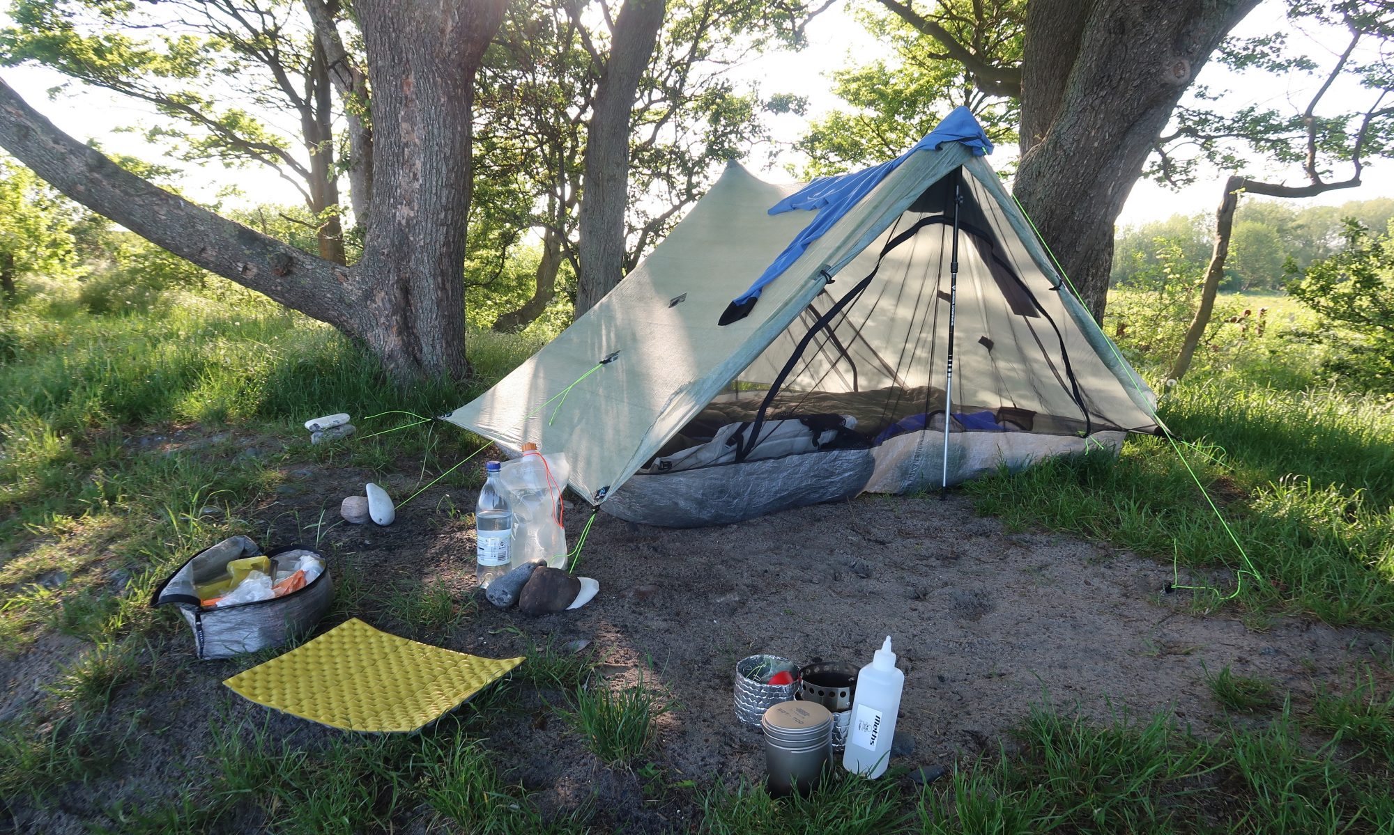
I set about locating an acceptable spot to pitch the Ultamid 2. The area was very uneven, rocky and hilly. There was also a shelter down by the lakeside which was more or less built right next to the waters edge. I found and an area some 50-100 meters or so away from the shelter. I wasn’t counting on anyone showing up here as the location was not marked on maps, it was remote, it was now dark and it was the middle of winter on a cold January night. What would be the odds? 😬
After I was settled in I made a cup of coffee and did some videoing for my YouTube channel. I was testing a new camp lantern from Tread Lite Gear (TLG) called the MK2 rechargeable DCF lantern which weighs 27 grams.
This is not the first time that I have written about TLG. I have purchased several bits of kit from TLG including the very first model TLG camp lantern that weighed only 8 grams. I have written about it here. Below the TLG MK2 lantern is lighting up the Ultamid 2 with no special effects, long exposure or flash used. I’ll try to do some more professional shots next time, but my first impressions are very good ones. I had it turned on in the shelter for about 4 hours. It works great .
Disclosure: The TLG MK2 lantern was provided free of charge from Tread Lite Gear with no obligation to provide media coverage or a product review. I do not accept compensation or donated product in exchange for guaranteed media placement or product review coverage without clearly denoting such coverage as an “ADVERTISEMENT” or “SPONSORED CONTENT.”
I was also testing a new headlamp that I recently purchased. The Nitecore NU25 rechargeable headlamp with UL headband weighing only 36 grams. I removed the heavier standard headband and fitted it with the cord headband from my Asivik H Mini headlamp. With the standard headband the NU25 weighed 54 grams. The 2 mm thick elastic cord is uncomplicated to attach. The tail loop design makes it easy and fast to adjust. It is from my very first lightweight headlamp that I have used for some years called the Asivik H Mini headlamp. It weighs 31 g but uses two CR2032 batteries. The H Mini is no longer available and can not be purchased from the retailers.
While I was cleaning my teeth before heading off to bed I noticed a pair of eyes in the distance staring back at me. They were too high off the ground for a wild boar. Perhaps it was a deer however I’m not sure. I switched my headlamp to the brightest mode. I was very impressed with how bright the Nitecore NU25 is. However I still couldn’t make out what sort of animal was staring at me and eventually it disappeared.
Before heading off to bed I placed all my garbage down in the shelter by the lake so no wild boar would find my camp interesting in the middle of the night. However, it turned out that something or better said someone else would invade my camp later at midnight …
I was awoken by some loud machines and bright lights at 23:40pm! Keep in mind that this location could only be reached by boat or on foot or so I thought that was the case. The interruption to my deep sleep was some people on motor-cross bikes who had planned to have a mid-night BAR-B-Q down by the lake 😕 … very weird! Twenty minutes after their arrival they walked up to my shelter shining their lights directly into the Ultamid and wanted to chat. They said that they were freaked out by my tent. I answered them by replying that I was freaked out by them and that I thought it very strange to arrive at midnight to have a BAR-B-Q. They had no plans to sleep at the shelter. They shined their lights all night. They must of had them mounted on the shelter somewhere. They rode away at 06:20am 😠.
When I first walked down to the lake that afternoon I didn’t know there was a shelter down there. There were no shelters marked on my map an no signs indicating that it was there. It was also a narrow side walking trail off the main trail. The lakeside location was a remote one and I didn’t expect something like this to happen in the middle of a dark winter night in January. The location of the lakeside shelter is N56° 18.052′ E14° 16.595′.
Day 2 – Saturday January 25, 2020
I was out of bed around 7am. I wanted to make sure that my guests were completely gone so I walked down to the waterside shelter. My garbage was still in the shelter untouched. I noticed that one of the motor-cross bikes had been abandoned not far from the shelter. On close inspection I could see that it had broken down as it appeared that they had been working on it. There were also some batteries laying scattered on the ground next to it. These were clearly people who loved the back country and cared about the environment 🤔.
I set about my morning ritual of toilet visit, breakfast and coffee. Always packing my Deuce of Spades UL trowel, number 2’s are buried responsibly as it should be done. I don’t know how many times I’ve seen toilet paper among other things laying around in the forest.
Departure was at 9:15am. I headed in a north-easterly direction on some forest tracks. I would not be hiking on Skåneleden until later in the day. The walk first takes me by three small lakes Krokgylet, Trollagylet and the larger Ekeshultssjön. After Ekeshultssjön I emerged from the forest and headed north on the main road which would take me through Grimsboda and finally to Vesslarp. I noted that it was possible to catch a bus to and from Grimsboda.
Now I was on familiar turf; I had walked through here both in June 2017 and again in September the same year. Joining the Skåneleden trail once more I first headed into the forest on the east side of the road only to cross it again 150 m further up. Then there is a short 250 m down to the Vesslarp shelter.
The Vesslarp Shelter on Skåneleden SL1 trail located between stages 5 & 6 is a beautiful site situated by the Tommaboda stream. There is not a lot of room to pitch an Ultamid but if you are into shelters then this is the place. In June 2017 I took a break for lunch here and now this time as I pass through once again. You can view a lot more of this site on my YouTube video if you wish. The link is at the bottom of this post.
Before leaving I studied the map on the official Skåneleden sign. I noticed that I would turn up far too early at the planned site for camp 2. Then I eyed a dam site at Stora Björkeröd which actually is an old quarry filled with water. I could camp around there I thought. The trail from Vesslarp now takes me in the opposite direction due west. At the 10 km marker for the day I arrive at a main road where you then have to turn north and walk for 270 meters before entering the forest once again. At the 10.7 km marker I emerged from the forest and at the same time a Swedish couple, who were out for a stroll, met me. We greeted one another and started chatting. In the meantime I didn’t notice that I should of walked straight ahead. I kept talking with my new found friends and in the meanwhile headed in the wrong direction north. After about 200 meters I checked my position and told them that I would be backtracking as I should of walked west on Skåneleden. They were complaining that there had been no winter this year; they were really longing for some snow.
I followed the trail around lake Vesslarpssjön. On the north side of the lake I noticed that some locals had just placed their boat in the water and were heading out to fish. I reached the campsite at 1pm. I noticed that there was just enough room to pitch my Ultamid if I wanted to. Collecting 600 ml of water from the lake in my Katadyn BeFree water bottle I started out once again.
When I emerged from the Skåneleden trail on the south end of lake Vesslarpssjön I then walked on a forest track for nearly 2 km until I merged onto another trail named Breanäsleden which is also Skåneleden SL1 stage 6A. I walked on the former Grisabanan, an old train track, along the river to Stora Björkeröd and further along the edge of the water-filled quarry. The narrow-gauge track carried from 1905 to 1934 granite blocks away from the quarry to the little town of Lönsboda. Grisabanan translated is the pig track. The name Grisabanan is because the whistle of the locomotive sounded like a wailing pig. The steam engine was christened Hägghultsgrisen – “The Hägghult Pig”.
At the 20 km marker I reached the old quarry at Stor Björkeröd which was filled with water. With ropes hanging down from the stone wall on the opposite side I gathered that this was the local swimming hole through the summer months. I noticed that an emergency pitch for the Ultamid could of been arranged as you can see above. Although it would not have been very private; I am sure that the locals would of been out for a walk around here. All my plans had now changed. I knew now that I would be cutting short my 3 day hike down to a 2 day one.
At the 22 km marker, which was at the village of Högsma the Högsma Bygdegård (a hostel) offers a water supply by means of an outdoors water faucet. The water is also available through the winter months as the tap is guarded against the freezing temperatures of which we have not been experiencing this year.
At the 23.5 km marker I pass over an old stone arch bridge. The information sign next to the bridge which is written in Swedish BTW explains some history on stone arch bridge building. In my YouTube video I said that the bridge is from the 1700s this is not exactly correct as the sign merely explains the progression of building bridges from the 18th century and onwards. It goes on to talk about the most common construction types and mentions something about cold-brick and wedged stones or something. Perhaps my Swedish friends can correct me and elaborate on this a little?
After the stone bridge the trail starts veering west around the 25 km mark. It was here that the blazers disappeared for me. After walking for some 160 m I decided to backtrack until I located the last visible blazer. Then I followed the trail in the same direction once again. This time I noticed that the trail swings sharply to the west and so I was back on track once again with blazers and all. There was no apparent sign at the turn like there normally is and I was videoing when I came by the first time so I missed the turn 🤭.
From the turn-off the trail takes me in a south-westerly direction back towards Sibbhult where the car was parked. 1.5 km from the turn-off I crossed a bridge with the fast flowing Högsmaån below me. I have now covered so far 27 km for the day. The trail then takes you onto the west side of the main road and behind town finally arriving back at the car.
I ended up clocking in just below 30 km for the day which is not bad for this time of the year (and an old guy) where the sun rises at 8:10am and sets at 4:18pm. I was back at the car at 4pm and the temperature was 6℃ with cloudy skies. The wind was blowing at 3m/s. Even though my trip was cut short by one planned day it felt great to get some decent milage covered for this time of the year.

Are there any bears in that area?
LikeLike
Chrissie, brown bears are very rarely seen in Sweden. They are also very shy. But to answer your question, no. They live in the northern two thirds of the country. I have however seen moose in the area once.
LikeLiked by 1 person